
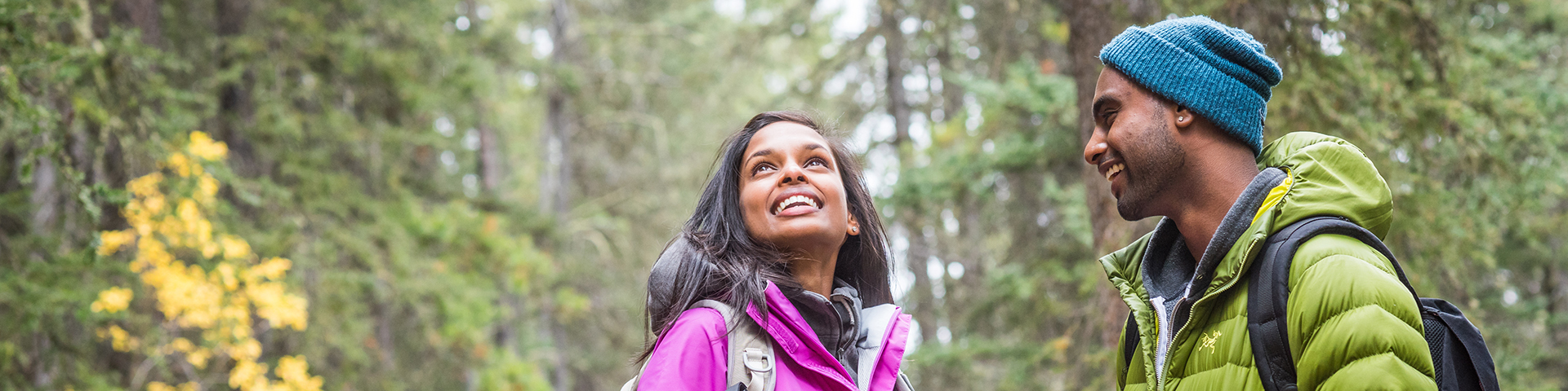
Hiking
Banff National Park
Watch the sunset on a riverside stroll or feel the breath of glaciers in the alpine. Take your pick of over 1,600 kilometres (1,000 miles) of maintained trails. Many of the park’s most famous hikes are easily accessible from the town of Banff and the community of Lake Louise.
Prime hiking season runs July through mid-September. Until late June, many passes are still snow-bound and may be subject to avalanche hazard. Trails tend to be muddier at this time and the best hiking is at lower elevations or on drier, south facing slopes around the town of Banff. By the middle of July, most alpine passes are snow-free.
Important information
Safety
Your safety is your responsibility. There are always hazards associated with outdoor recreation. Even short trips can have serious consequences.
- Check the weather forecast, current trail conditions, warnings and closures or visit a Parks Canada visitor centre.
- Be prepared for emergencies. Mountain weather changes quickly and it can snow any month of the year. Dress in layers, bring warm clothing, extra food and your own water or water filter: surface water may be unsafe to drink.
- Study descriptions and maps before heading out. Always choose a hike suitable for the least experienced member in your group.
- Travel with others and keep your group together.
- Be prepared and have knowledge about self rescue. Help is not always immediately available.
- Be prepared to survive overnight.
- Carry a first aid kit, bear spray and a satellite emergency communication device and know how to use them.
- Tell a reliable person where you are going, when you will be back, and who to call if you do not return: Banff Dispatch – 403-762-1470.
- Ticks, which can carry diseases, may be present in the park. It is important to check yourself and your pet after hiking.
- Avoid wearing earbuds or headphones. Be alert at all times.
- In case of EMERGENCY, call 911 or satellite phone: 403-762-4506. Cell phone coverage is not reliable throughout the national park.
⚠Snowy trails and season avalanche risk
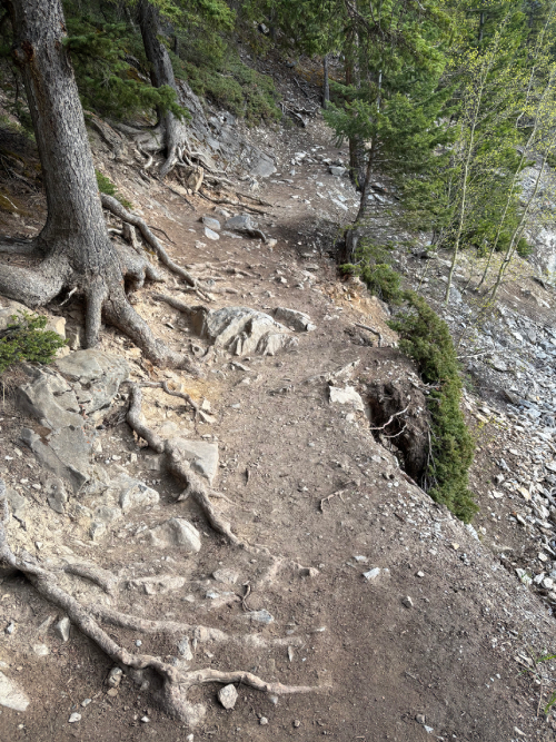
Snow can remain on some trails well into the summer. When trails are snow or ice covered, route finding can be difficult and unsafe. Hiking poles and ice cleats are recommended when trails are snowy or icy. Check trail conditions before heading out.
Trails above the tree line (2 000 m) may be exposed to avalanche hazard year-round especially from November through June. Snow on steep slopes has the potential to slide.
- Check the Avalanche Bulletin for the latest conditions.
- For more information visit a Parks Canada visitor centre or check the Mountain Safety section.
Recommended packing list
✔ Trail guide and map
✔ Full water bottle or thermos
✔ High energy food
✔ Bear spray
✔ Sunscreen and sunglasses
✔ First aid kit and emergency blanket
✔ Headlamp or flashlight with spare batteries
✔ Hat and gloves
✔ Proper footwear
✔ Hiking poles
✔ Rain/wind jacket
✔ Extra warm clothing in case of an emergency
✔ Fully charged cell phone
✔ Satellite emergency communication device
Trail ratings
|
Easy |
|
|
|
|
|
|
|


Etiquette and regulations
- To prevent damage to vegetation and ensure your safety, stay on designated trails at all times.
- Trails are used by a variety of outdoor enthusiasts. Be sure to yield to others.
- Dispose of human waste at least 100 m from any water source if you are too far from a toilet. Bury solid human waste in a hole 15 cm deep. Pack out your toilet paper.
- Leave no trace. Pack out everything you pack in.
- For the safety of wildlife, your pet, and yourself, keep your dog on a leash and under physical control at all times.
- Leave what you find —it is the law. Natural and cultural resources such as rocks, fossils, artifacts, horns, antlers, wildflowers and nests are protected and must be left undisturbed for others to discover and enjoy.
Where to hike in Banff National Park
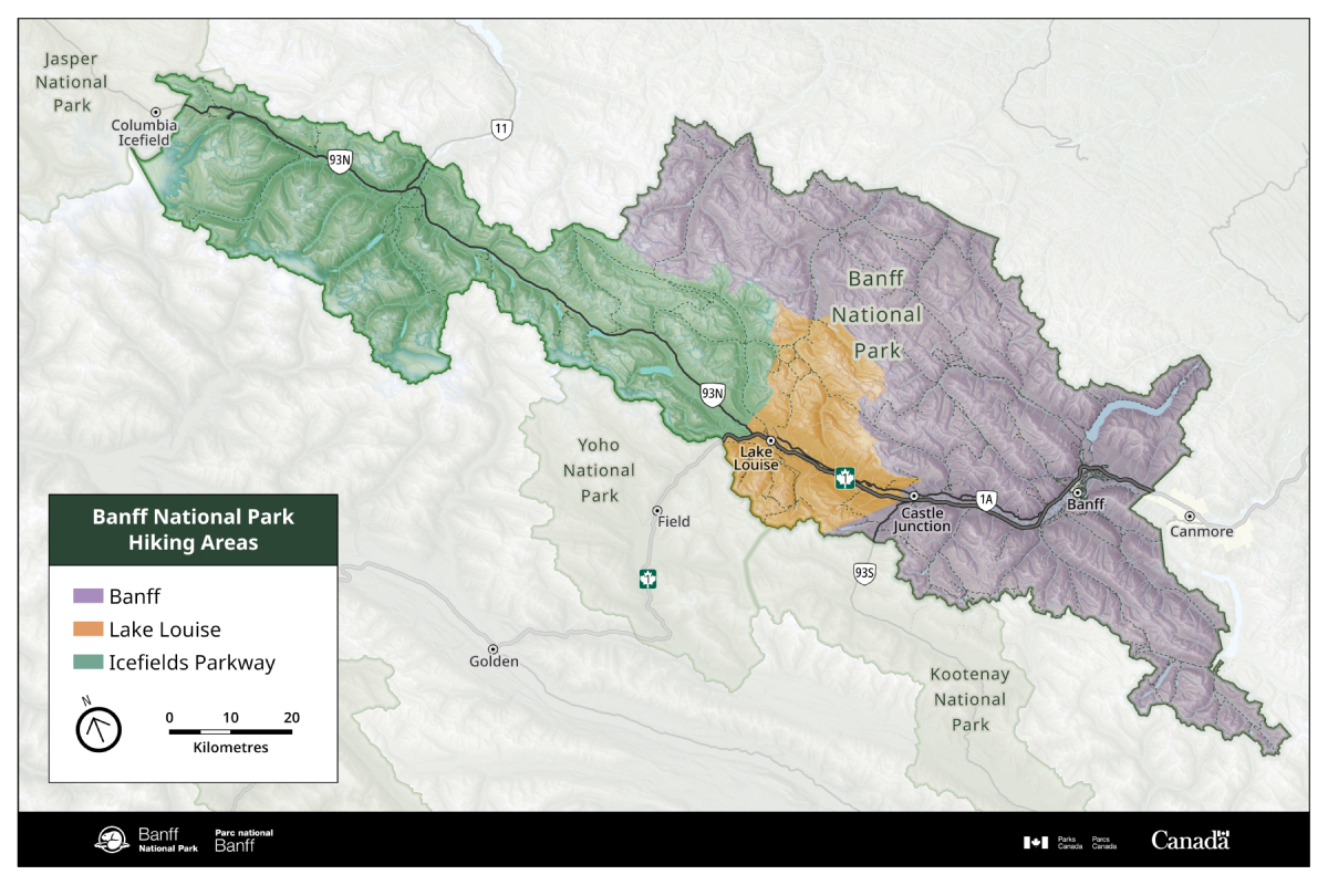
Banff area
| Hikes | Distance | Estimated time round trip |
 Fenland
Loop Fenland
Loop |
1.9 km loop | 40 minutes |
| Marsh
Trail |
1.5 km one way | 1 hour |
| Lake
Minnewanka Trail (to Stewart
Canyon) |
1.6 km one way | 1 hour |
| Silverton
Falls Trail |
0.9 km one way | 40 minutes |
| Johnson
Lake Loop |
2.9 km loop | 1 hour |
| Arnica
Lake Trail (to Vista
Lake) |
1.4 km one way | 1.5 hour |
| Tunnel
Campground Loop |
6.3 km loop | 1.5 hour |
| Johnston
Canyon Trail (to Lower
Falls) |
1.1 km one way | 1 hour |
| Johnston
Canyon Trail (to Upper
Falls) |
2.4 km one way | 2 hours |
| Boom
Lake Trail |
5.1 km one way | 3 to 4 hours |
| Spray
River East Trail |
5.6 km one way | 3 to 4 hours |
| Spray
River West Trail |
5.7 km one way | 3 to 4 hours |
| Sunshine
Meadows trails |
10.2 km of trails | 4 to 5 hours |
 Upper
Stoney Trail Upper
Stoney Trail |
4.4 km loop | 1.5 hours |
| Tunnel
Mountain Summit Trail
|
2.3 km one way | 2 hours |
| Surprise
Corner to Hoodoos
viewpoint |
4.4 km one way | 3 hours |
| Sundance
Canyon Loop |
9.5 km round-trip | 3 hours |
| C-Level
Cirque Trail |
3.8 km one way | 3 hours |
| Sulphur
Mountain Trail |
4.8 km one way | 4 hours |
| Arnica
Lake Trail (to Arnica
Lake) |
4.6 km one way | 5 hours |
|
Ink
Pots Trail |
5.5 km one way | 4 hours |
| Bourgeau
Lake Trail |
6.7 km one way | 6 hours |
| Healy
Pass Trail |
8.8 km one way | 6 to 7 hours |
| Rockbound
Lake Trail |
8.5 km one way | 6 to 7 hours |
| Cascade
Amphitheatre Trail
|
6.8 km one way | 6 hours |
| Arnica
Lake Trail (to Lower Twin
Lake) |
7.4 km one way | 6 to 7 hours |
| Harvey
Pass Trail |
8.9 km one way | 6 to 7 hours |
 Cory
Pass Loop Cory
Pass Loop |
13 km one way | 6 hours |
| Aylmer
Lookout Trail |
11.6 km one way | 7 to 8 hours |
| Aylmer
Pass Trail |
13.1 km one way | 8 to 9 hours |
*Estimated time to complete these trails is round-trip on foot and varies depending on trail distances, fitness level, weather and trail conditions.
Easy hikes
Fenland Loop
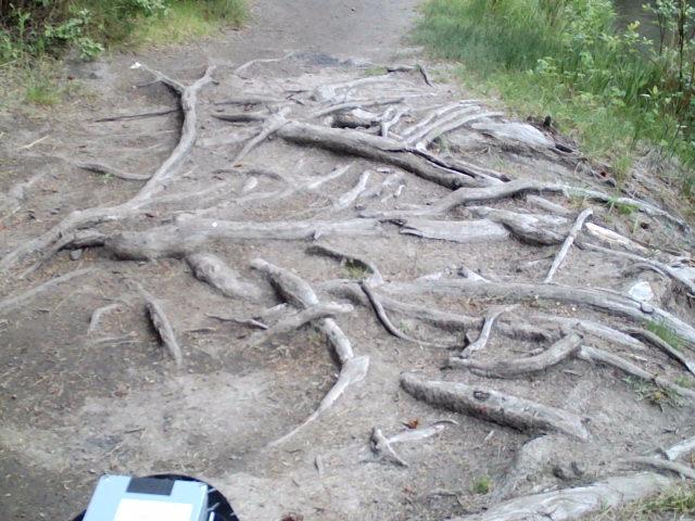
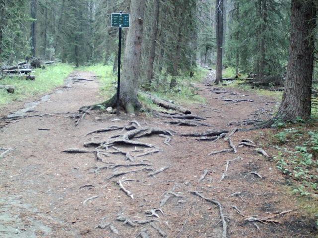
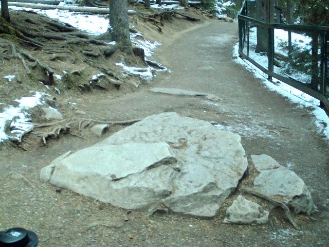
This self-guided interpretive trail passes through an old-growth spruce forest. The mostly hard soil path has significant root patches.
Distance: 1.9 km loop
Elevation gain: 20 m
Estimated time: 40 minute round trip
Trailhead
Fenland Trail parking area, located west of Mount
Norquay Road. Trailhead is a 20 minute/1.5 km walk northwest of downtown Banff.
Amenities: limited paved parking including one accessible stall, 2 gender neutral outhouses and picnic
tables.
Trail details
Surface: 83% hard soil, 15% hard aggregate/gravel
and 2% wood-decking.
Width: typical – 162 cm, minimum – 62 cm.
Grade: typical – 3%,
maximum – 26%.
Cross slope: typical – 3%, maximum – 21%.
First significant obstacle
Roots, 237 m counterclockwise from trailhead:
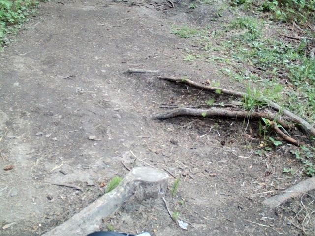
Root patch, 746 m clockwise from trailhead:
Benches: 850 m, 950 m, 1.2 km and 1.7 km clockwise from trailhead.
 Marsh Trail
This trail encircles a wetland filled from hot springs flowing out of the lower slopes of Sulphur Mountain. This is a good place to observe birds and waterfowl. The path is mostly uneven due to heavy horse use and muddy in wetter conditions.
Distance: 1.5 km one
way
Elevation gain: 15 m
Elevation loss: 20 m
Estimated time round trip: 1 hour
Trailhead
Cave and Basin National Historic Site, located at the end of
Cave Avenue. Trailhead is a 30 minute/2 km walk southwest of downtown Banff.
Roam Route
4
(summer only)
Amenities: paved parking including 6 electric vehicle charging stations and 4 accessible parking stalls,
bike rack, accessible flush toilets, picnic tables and benches.
Trail details
Surface: 61% hard soil, 25% hard aggregate/gravel, 13% firm
soil and 1% wood-decking.
Width: typical – 287 cm, minimum – 200 cm.
Grade: typical
– 3%, maximum – 23%.
Cross slope: typical – 4%, maximum – 18%.
Lake Minnewanka Trail (to
Stewart Canyon)
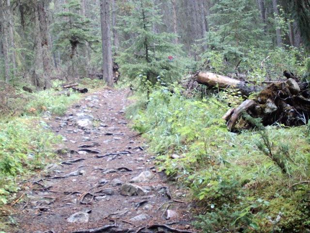
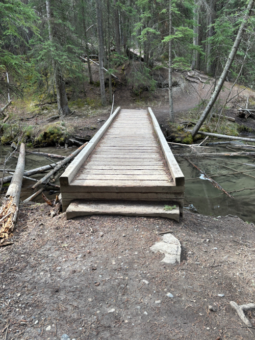
This rolling shoreline trail leads to a bridge spanning the walls of Stewart Canyon. It begins with a rough 800 m of paved road through the day-use area followed by a natural hard trail, partially exposed in sections. Significant rock and root sections begin 1 km from the trailhead.
Distance: 1.6 km one
way
Elevation gain: 30 m
Elevation loss: 10 m
Estimated time round trip: 1 hour
Trailhead
Lake Minnewanka Day-use Area located 10 km northeast of
downtown Banff on the Lake Minnewanka Road.
Roam
Route 6
(summer only)
Amenities: limited paved parking including 5 accessible stalls, bike rack, accessible flush
toilets,
picnic tables and one bench.
Trail details
Surface: 49% paved, 47% firm soil, 2% hard
aggregate/gravel and 2% wood-decking.
Width: typical – 274 cm, minimum – 100 cm.
Grade:
typical – 5%, maximum – 29%.
Cross slope: typical – 5%, maximum – 31%.
First significant obstacle
Rock and root patch with some exposure, 1 km from trailhead:
Rest areas
Benches: 234 m, 258 m, 632 m and 711 m from main parking
lot.
Picnic shelter: 332 m and 737 m from main parking lot.
Picnic table: 661 m from main parking lot.
Silverton Falls
Trail
This short trail branches off the Rockbound Lake Trail at the 300 m mark. It ends on an exposed hillside at the base of a waterfall that cascades over a series of narrow ledges. It has narrow sections and extensive root and rock patches.
Distance: 0.9 km one
way
Elevation gain: 85 m
Elevation loss: 5 m
Estimated time round trip: 40 minutes
Trailhead
Rockbound Lake parking area located 32 km northwest of Banff,
27 km southeast of Lake Louise, and just east of Castle Junction on the Bow Valley Parkway.
Amenities: limited paved parking, bike rack and 2 gender neutral outhouses.
Trail details
Surface: 100% firm soil.
Width: typical – 147 cm, minimum – 47 cm.
Grade: typical
– 8%, maximum – 30%.
Cross slope: typical – 4%, maximum – 32%.
First significant obstacle
Rock and root patch, 330 m from trailhead:
Johnson
Lake Loop
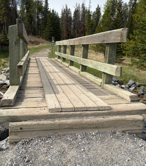
This rolling circuit around a lake has views of Cascade Mountain and Mount Rundle. It crosses open slopes, passing some of Alberta’s oldest Douglas fir trees. The trail has a mix of uneven paved and natural surface with a lot of roots, rocks, some step bridges and a narrow section on the north shore.
Distance: 2.9 km loop
Elevation gain: 90 m
Estimated time round trip: 1 hour
Trailhead
Johnson Lake Day-use Area located 12 km east of Banff, at the
end of Johnson Lake Road, off Lake Minnewanka Road.
Roam
Route 6
(summer only)
Amenities: limited paved parking including 4 accessible stalls, bike rack, 4 accessible gender
neutral
outhouses and picnic tables.
Trail details
Surface: 67% firm soil, 21% hard aggregate/gravel, 6%
concrete, 3% asphalt, 1% wood-decking and 1% soft soil.
Width: typical – 90 cm, minimum – 44
cm.
Grade: typical – 6%, maximum – 31%.
Cross slope: typical – 5%, maximum –
22%.
First significant obstacle
Bridge step, 450 m clockwise from trailhead:
Bridge step, 100 m counterclockwise from trailhead:
Rest areas
Picnic tables: 60 m, 120 m, 2.7 km and 2.8 km clockwise from
trailhead.
Benches: 1.2 km clockwise from trailhead.
Tunnel Campground
Loop
This lightly forested trail with mountain views can be joined at any number of points from within the campground. The path is mainly packed gravel with minimal low shallow roots and small soft soil and loose gravel patches. There is no designated parking lot; walk, ride your bike or take Roam Public Transit from downtown to access this trail.
Distance: 6.3 km loop
Elevation gain: 110 m
Estimated time round trip: 1.5 hour
Trailhead
There is no formal trailhead for this trail. Start at the
Hidden Ridge Resort Roam Transit stop which is a 35 minute/2.5 km walk northeast of downtown Banff or access
the loop from trail connectors within the campground.
Trail details
Surface: 93% firm aggregate/gravel, 3% soft soil, 2% asphalt,
1% firm soil/vegetation and 1% soft aggregate/gravel.
Width: typical – 173 cm, minimum – 40
cm.
Grade: typical – 4%, maximum – 20%.
Cross slope: typical – 3%, maximum –
12%.
Bench: 230 m clockwise from suggested trailhead.
Johnston Canyon
Trail
This uneven paved path takes you into the depths of a canyon on narrow bridges with railings. It leads to the Lower Falls and to the 30 metre-high Upper Falls. For a unique perspective, continue 265 m further to the viewpoint at the top of the Upper Falls. This trail is busy, and it can be difficult to pass other users in narrow sections. Strollers are not recommended.
To Lower Falls
Distance: 1.1 km one way
Elevation gain: 85 m
Elevation loss: 55 m
Estimated time round trip: 1 hour
To Upper Falls
Distance: 2.4 km one way
Elevation gain: 215 m
Elevation loss: 125 m
Estimated time round trip: 2 hours
Trailhead
Johnston Canyon Day-use Area located 25 km northwest of Banff
and 33 km southeast of Lake Louise, on the Bow Valley Parkway. Parking fills quickly. Park only in
designated parking spots.
Roam
Route
9 (summer
only)
Amenities: limited paved parking including 8 accessible stalls, bike rack, accessible flush toilets, picnic
tables and benches.
Trail details
To Lower Falls
Surface: 100% paved.
Width: typical – 182 cm, minimum – 150 cm.
Grade: typical – 8%,
maximum – 26%.
Cross slope: typical – 4%, maximum – 28%.
To Upper
Falls
Surface: 85% paved, 8% concrete, 5% hard surface and 1%
wood-decking.
Width: typical – 158 cm, minimum – 75 cm.
Grade: typical – 10%,
maximum – 30%.
Cross slope: typical – 6%, maximum – 28%.
First significant obstacle
Large rock, 765 m from trailhead:
Benches: 450 m, 800m, 900 m, 1.2 km, 1.6 km, 2 km, 2.1 km, 2.2 km and 2.4 km from trailhead.
Boom Lake
Trail
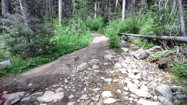
This forested trail leads to a large alpine lake surrounded by mountains. This is a bumpy path through sections of rocks, boulders, roots, wet and muddy spots, and some small streams.
Distance: 5.1 km one
way
Elevation gain: 180 m
Estimated time round trip: 3 to 4 hours
Trailhead
Boom Lake Day-use Area located 38 km northwest of Banff and 32
km southeast of Lake Louise, on the Highway 93 South.
Amenities: limited paved parking, 2 gender neutral accessible outhouses and picnic tables.
Trail details
Surface: 74% rock/boulder, 21% hard soil, 2% wood-decking, 1%
hard aggregate/gravel, 1% soft soil and 1% very soft soil.
Width: typical – 191 cm, minimum –
60 cm.
Grade: typical – 6%, maximum – 29%.
Cross slope: typical – 4%, maximum
– 21%.
First significant obstacle
Rock field in a stream, 890 m from trailhead:
Spray River East and
West trails
Often done as a loop, these two forested doubletrack trails are popular with hikers, cyclists and horseback riders. They traverse rolling terrain along either side of the Spray River and are linked by two small bridges. Both trails have some loose rocks sections and root patches. The first 250 m from the East trailhead is muddier in wet conditions due to horse use.
Spray River East Trail
Distance: 5.6 km one way from
Spray River East trailhead to Spray River bridge
Elevation gain: 145 m
Elevation loss: 100 m
Estimated time round trip: 3 to 4 hours
Trailhead
Spray River East trailhead located 2.5 km southeast of
downtown Banff on the Golf Course Road.
Roam Route
4 to Bow Falls (summer only): Trailhead is an 8 minutes/600 m walk from bus
stop.
Trail details
Surface: 38% firm soil, 35% hard soil, 20% hard
aggregate/gravel, 6% firm aggregate/gravel and 1% very soft soil.
Width: typical – 396 cm, minimum
– 100 cm.
Grade: typical – 3%, maximum – 17%.
Cross slope: typical – 3%,
maximum – 20%.
Covered benches: 5.6 km from trailhead.
Spray River West Trail
Distance: 5.7 km one way from
Spray River West trailhead to Spray River bridge
Elevation gain: 130 m
Elevation loss: 125 m
Estimated time round trip: 3 to 4 hours
Trailhead
Spray River West trailhead located at the end of Spray Avenue
past the Banff Springs Hotel. Trailhead is a 30 minute/2.2 km walk south of downtown Banff.
Roam Route 2 to
Banff Springs Hotel: Trailhead is a 7 minutes/500 m walk from bus stop.
Amenities: limited unlined gravel parking.
Trail details
Surface: 93% hard aggregate/gravel, 6% hard soil and 1% hard
rubber.
Width: typical – 334 cm, minimum – 100 cm.
Grade: typical – 4%, maximum
– 17%.
Cross slope: typical – 3%, maximum – 16%.
Covered benches: 5.7 km from trailhead.
Sunshine
Meadows
This is a network of paths around alpine lakes and meadows. The most popular trail in this network crests the Continental Divide and descends to a viewpoint at Rock Isle Lake. From there, you can hike the slightly more challenging Larix Lake and Grizzly Lake Loop, continue on the Twin Cairns-Meadow Park Trail or hike up to Standish viewpoint. Detailed trail maps are available through Sunshine Village. Trails are mostly uneven hard aggregate or gravel path with multiple rocks, exposed roots, narrow sections and steps up to 75 cm high. The Larix Lake and Grizzly Lake Loop features a 24 cm wide unrailed bridge.
Distance: 10.3 km of
trails
Elevation gain: 580 m
Estimated time round trip: 4 to 5 hours
Trailhead
Sunshine Village: accessible by a fee-based gondola from early
July to early September from the Sunshine Village parking area located 18 km southwest of Banff at the end
of the Sunshine Village Access Road, off the Trans-Canada Highway.
Sunshine
shuttle
(late June to mid September)
Amenities: mixed of paved and unlined gravel parking at Sunshine Village
base lot including 4 electric vehicle charging stations, flush toilets and benches.
Trail details
Surface: 95% hard aggregate/gravel, 3% wood-decking, 1% hard
soil and 1% rock/boulder.
Width: typical – 115 cm, minimum – 24 cm.
Grade: typical –
9%, maximum – 58%.
Cross slope: typical – 3%, maximum – 26%.
First significant obstacle
Series of four wooden cylinder step up to 15 cm high, over a 50 m distance, starting 200 m from the
trailhead on Rock Isle Road:
Cylinder log step 18 cm high, 180 m from the trailhead on the Twin Cairns Meadow Park Trail.
Benches:
- 550 m, 1.1 km, 1.2 km, 1.4 km, 1.7 km and 1.9 km on Rock Isle Road from Sunshine Village trailhead;
- 650 m and 3.2 km on the Twin Cairns-Meadow Park Trail from Sunshine Village trailhead;
- 10 m, 120 m, 210 m, 330 m, 350 m and 360 m on the Standish Viewpoint Loop and lookout from Standish Chairlift;
- 130 m, 170 m, 250 m, 360 m and 480 m from Standish Lookout Deck to Rock Isle Road junction;
- 70 m, 130 m, 310 m, 350 m, 440 m, 790 m and 920 m from Rock Isle Road junction to the Larix Lake and Grizzly Lake Loop junction;
- 130 m, 450 m, 1.1 km, 1.6 km and 2.1 km on the Larix Lake and Grizzly Lake Loop.
Moderate hikes
Upper Stoney
Trail
This trail climbs through thick forest to the Stoney Lookout with views of Cascade Mountain and the Bow Valley. It loops back down north connecting with the old ski runs above the Mount Norquay day lodge. This is a narrow, twisty, rocky singletrack with root patches.
Distance: 4.4 km loop
Elevation gain: 210 m
Estimated time round trip: 1.5 hour
Trailhead
Kiosk at the south end of Mount Norquay Ski Area parking
area located 7 km north of downtown Banff, at the end of the Mount
Norquay Road.
Norquay
Shuttle
Amenities: limited unlined gravel parking.
Tunnel Mountain
Summit Trail
This trail switchbacks to a low summit with views of the town of Banff, the Bow Valley and Mount Rundle rising to the south. This is a path with rock and root patches and few concrete steps at the lower and upper trailheads.
Distance: 2.3 km one
way
Elevation gain: 275 m
Estimated time round trip: 2 hours
Trailheads
- Lower parking area on St. Julien Road. Trailhead is a 15 minute/1 km walk east
of downtown Banff.
Amenities: limited unlined gravel parking and bike rack.
- Upper parking lot on Tunnel Mountain Drive located 2 km east of downtown
Banff. Park only in designated parking area. Parking on the road is illegal and unsafe.
Amenities: limited paved parking and bike rack.
Trail details
Surface: 80% soft soil, 11% hard aggregate/gravel, 7%
hard soil, 1% hard bedrock and 1% hard concrete.
Width: typical – 213 cm, minimum – 76 cm.
Grade: typical – 12%, maximum – 31%.
Cross slope: typical – 6%, maximum – 34%.
Surprise
Corner to Hoodoos viewpoint
This trail passes below the steep cliffs of Tunnel Mountain and meanders along the Bow River. As the final section of trail ascends, views open across the Bow Valley to Mount Rundle. In the summer, Roam Public Transit route 2 provides an easy option for returning to town from nearby Tunnel Mountain Campground. This trail has many patches of exposed roots and a few steep climbs and descents. There are some sets of steps at the trailhead and 1 km down the trail from the Surprise Corner trailhead.
Distance: 4.4 km
one way
Elevation gain: 115 m
Elevation loss: 90 m
Estimated time round trip: 3 hours
Trailheads
- Surprise Corner located southeast of downtown Banff at the end of Buffalo
Street. Trailhead is a 20 minute/1.6 km walk from downtown Banff.
Amenities: limited paved parking and bike rack. - Hoodoos Viewpoint and Day-use Area located 4 km northeast of downtown Banff on
the Tunnel Mountain Road.
Amenities: limited paved parking including 3 accessible stalls and 4 accessible gender-neutral outhouses.
Sundance Canyon Loop
From Cave and Basin National Historic Site, this paved trail starts in the forest for 1 km and opens to a mountain panorama across the Bow River. After a gentle steady climb in the forest and away from the river, the paved section ends where the Sundance Canyon hiking-only loop starts. A bike rack is available at the end of the paved trail. The clockwise loop is a steep narrow trail up and around a water-filled canyon with natural rock steps near the start.
Construction at Sundance Canyon bridge
Please be advised that there is an area closure along the Sundance Canyon Loop. The trail to the Sundance Canyon Loop viewpoint is still accessible. For more information, please see Important bulletins.
Distance: 3.7 km one way plus
2.1 km loop
Elevation gain: 190 m
Estimated time round trip: 3 hours
Trailhead
Cave and Basin National Historic Site located at the end of
Cave Avenue. Trailhead is a 30 minute/2 km walk southwest of downtown Banff.
Roam Route
4 (summer only)
Amenities: paved parking including 6 electric vehicle charging stations and
4 accessible stalls, bike rack, accessible flush toilets, picnic tables, benches and one seating
area.
C-Level Cirque
Trail
This trail goes past historic foundations and vents from the abandoned Bankhead mining operation. It heads to a massive glacially-carved cirque in the northern face of Cascade Mountain. Steep at times, it goes through rutted sections and rugged terrain.
Distance: 3.8 km one
way
Elevation gain: 440 m
Estimated time round trip: 3 hours
Trailhead
Upper Bankhead Day-use Area located 8.3 km northeast of
downtown Banff on the Lake Minnewanka Road.
Amenities: limited paved parking including 2 accessible stalls, 2 gender
neutral outhouses, picnic shelter and picnic tables.
Sulphur Mountain
Trail
This switchback-trail with exposed roots and rocks climbs steadily uphill to a summit with a 360º mountain views. At the top, a 500 m boardwalk along the ridge, with 368 shallow steps that go up and down, leads to a viewpoint.
From the boardwalk, return on the same trail to the parking lot. Alternatively, take a rocky old fire road known as the Sulphur Mountain Westside Trail (5.4 km) to Sundance Trail, ending at the Cave and Basin National Historic Site (2.6 km). Please note that if you choose to go down the west side trail, you will need to find your own transportation back to the Sulphur Mountain trailhead.
Distance: 4.8 km to top of
gondola, plus 0.5 km to Sanson Peak
Elevation gain: 655 m
Estimated time round trip: 4 hours
Trailhead
Banff Upper Hot Springs parking area located 4.3 km south of
downtown Banff at the end of Mountain Avenue. Please note that this parking area is very busy and fills
quickly. For the best experience, take public transit.
Roam Route
1
Amenities: limited paved parking including 6 electric vehicle charging
stations.
Trail details
Surface: 97% firm soil, 2% asphalt and 1%
wood-decking.
Width: typical – 205 cm, minimum – 54 cm.
Grade: typical – 13%,
maximum – 47%.
Cross slope: typical – 7%, maximum – 29%.
Ink Pots
Trail
From the Johnston Canyon Day-use Area, this trail follows the busy and uneven paved path of the Johnston Canyon Trail to the Upper Falls. Beyond the falls, a forested trail with exposed roots and rocks continues up and down to a meadow with the Ink Pots: shallow pools where water bubbles from deep below the Earth’s surface. From the Moose Meadows/Johnston Creek trailhead, the route covers the same distance as the Johnston Canyon Trail and follows a path with sections of roots and rocks.
Distance: 5.5 km one way
Elevation gain: 425 m
Elevation loss: 215 m
Estimated time round trip: 4 hours
Trailheads
- Johnston Canyon Day-use Area located 25 km northwest of Banff and 33 km southeast of Lake Louise, on the Bow Valley Parkway. Parking fills quickly. Park only in designated parking spots.
Roam
Route
9 (summer only)
Amenities: limited paved parking including 8 accessible stalls, accessible
flush toilets, picnic tables and benches.
- Moose Meadows/Johnston Creek parking lot located 27 km northwest of Banff and
31 km southeast of Lake Louise, on the Bow Valley Parkway.
Amenities: limited unlined paved parking.
Trail details
Surface: 80% firm soil, 15% hard soil, 3% asphalt, 1% hard
bedrock and 1% wood-decking.
Width: typical – 205 cm, minimum – 54 cm.
Grade: typical
– 13%, maximum – 47%.
Cross slope: typical – 7%, maximum – 29%.
Healy Pass
Trail
This rooty and rocky trail follows Healy Creek to its source amid open meadows above the treeline. Wildflowers bloom from mid-July to late August, and scattered alpine larches turn a golden yellow in late September.
Distance: 8.8 km one
way
Elevation gain: 650 m
Estimated time round trip: 6 to 7 hours
Trailhead
Sunshine Village parking area located 18 km southwest of Banff
at the end of the Sunshine Village Access Road, off the Trans-Canada Highway. Trail starts behind the main
gondola building.
Sunshine
shuttle
(late June to mid September)
Amenities: mixed of paved and unlined gravel parking at Sunshine Village
base lot including 4 electric vehicle charging stations, flush toilets and benches.
Cascade Amphitheatre
Trail
From the Mount Norquay day lodge, walk the gravel road all the way to the third chairlift (Mystic Express). From there, the forested trail starts with some rock and root patches. It ends at an opening to a meadow surrounded by a natural amphitheatre. From the end of the maintained trail, experienced scramblers with proper equipment can attempt the summit of Cascade Mountain.
Get route finding information in the Scrambler’s Guide to Cascade Mountain or at a Parks Canada visitor centre.
Distance: 6.8 km one
way
Elevation gain: 740 m
Elevation loss: 200 m
Estimated time round trip: 6 hours
Trailhead
Kiosk at the south end of Mount Norquay Ski Area parking area
located 7 km north of downtown Banff, at the end of the Mount Norquay Road.
Norquay
Shuttle
Amenities: limited unlined gravel parking.
Rockbound Lake
Trail
This is a long steady climb through a mixed forest on a path with many roots and rocks sections. It leads just behind the cliffs of Castle Mountain to open meadows and the flower-fringed Tower Lake, 7.5 km from the trailhead. The trail then climbs a low cliff band and emerges in a glacial cirque filled by Rockbound Lake.
Distance: 8.5 km one
way
Elevation gain: 765 m
Estimated time round trip: 6 to 7 hours
Trailhead
Rockbound Lake parking area located 32 km northwest of Banff,
27 km southeast of Lake Louise, and just east of Castle Junction on the Bow Valley Parkway.
Amenities: limited paved parking, bike rack and 2 gender neutral outhouses.
Arnica Lake
Trail
This trail starts with a short downhill to Vista Lake on a narrow path with some exposed roots and rocks. Then, a long uphill with switchbacks through larch trees leads to Arnica Lake sitting at the foot of Storm Mountain. From there, the trail goes up and down to the Upper Twin Lake through a mosaic of wildflowers, followed by a descent to the Lower Twin Lake.
to Vista Lake
Distance: 1.4 km one way from
trailhead
Elevation loss: 110 m
Estimated time round trip: 1.5 hour
Trail details
Surface: 90% hard soil, 5% hard rock/boulder, 2% hard
aggregate/gravel, 2% soft soil and 1% hard wood-decking.
Width: typical – 75 cm, minimum – 32
cm.
Grade: typical – 11%, maximum – 33%.
Cross slope: typical – 7%, maximum –
42%.
to Arnica Lake
Distance: 4.6 km one way from
trailhead
Elevation gain: 580 m
Elevation loss: 110 m
Estimated time round trip: 5 hours
to Lower Twin Lake
Distance: 7.4 km one way from
trailhead
Elevation gain: 700 m
Elevation loss: 295 m
Estimated time round trip: 6 to 7 hours
Trailhead
Vista Lake viewpoint, located 40 km northwest of Banff and 34
km southeast of Lake Louise, on the east side of the Highway 93 South. Park only in the designated parking
area. Parking on the highway is illegal and unsafe.
Amenities: limited unlined paved parking.
Bourgeau Lake and
Harvey Pass trails
The trail to Bourgeau Lake is a steady climb through the forest. The path travels through root and rock patches and across mountain streams. Bourgeau Lake is uniquely enclosed in a glacially carved amphitheatre. From the lake, a 2.2 km ascent on a rough and rocky trail, past small lakes, leads to the Harvey Pass and its extensive views of mountain peaks.
to Bourgeau Lake
Distance: 6.7 km one way from
trailhead
Elevation gain: 730 m
Estimated time round trip: 6 hours
to Harvey Pass
Distance: 8.9 km one way from
trailhead
Elevation gain: 1010 m
Estimated time round trip: 6 to 7 hours
Trailhead
Bourgeau Lake parking area located 13 km west of Banff on the
Trans-Canada Highway. Park only in designated parking area. Parking on the highway is illegal and
unsafe.
Amenities: limited paved parking and 2 gender neutral outhouses.
Difficult hikes
Cory Pass Loop
This is an uphill trek to a pass with views of surrounding Rocky Mountains including Mount Louis, an imposing limestone monolith. This is a steep, rocky and exposed path with narrow sections. Rather than returning via the same route from the pass, hikers have the option of descending into the Gargoyle Valley before returning to the trailhead via Edith Pass. Route finding skills are required.
Distance: 11.7 km loop
Elevation gain: 930 m
Estimated time round trip: 6 hours
Trailhead
Fireside Day-use Area located 8.3 km west of Banff. The road
to the day-use area is on the right, just before the east entrance archway of the Bow Valley Parkway.
Trailhead access may be affected during the Bow
Valley Parkway Cycling Experience.
Amenities: limited unlined gravel parking, gender neutral outhouses and picnic tables.
Aylmer Lookout
Trail / Aylmer Pass Trail
This trail follows the rolling Lake Minnewanka Trail along the shoreline for 7.8 km to the Aylmer Pass Trail junction. From there, a 2.3 km steady uphill leads to a second junction with the Aylmer Lookout Trail. At this intersection, one trail continues to the Aylmer Pass (3.4 km one way) and the other climbs to Aylmer Lookout (1.7 km one way). Aylmer Pass opens to wide meadows of wildflowers and views of the slate-grey Palliser Range. Aylmer Lookout is a decommissioned fire lookout with views of Lake Minnewanka reservoir and the surrounding mountains. The two trails both feature significant roots, rocks and narrow sections.
A group access restriction occurs on this trail from July 10 to September 15 annually. Other bear warnings, restrictions and closures are common throughout summer. Get current trail information.
to Aylmer Lookout
Distance: 11.6 km one way
from trailhead
Elevation gain: 770 m
Elevation loss: 240 m
Estimated time round trip: 7 to 8 hours
to Aylmer Pass
Distance: 13.1 km one way
from trailhead
Elevation gain: 970 m
Elevation loss: 190 m
Estimated time round trip: 8 to 9 hours
Trailhead: Lake Minnewanka
Day-use Area located 10 km northeast of downtown Banff on the Lake Minnewanka Road.
Roam
Route
6
(summer only)
Amenities: limited paved parking including 5 accessible stalls, bike rack,
accessible flush toilets, picnic tables and one bench.
Lake Louise area
Moraine Lake Road is closed to personal vehicles year-round.
Parks Canada shuttles and commercial vehicle operators who are
licensed to operate on Moraine Lake Road are permitted from June to mid-October. Exceptions will be made for
visitors with valid, government-issued accessible parking placards and registered guests of Moraine Lake
Lodge.
| Trail | Distance (one-way) | Estimated time round trip |
| Lake
Louise Lakeshore |
2.3 km | 1 hour |
| Fairview
Lookout |
1.2 km | 45 minutes |
| Bow
River |
Up to 5.7 km | 2 hours |
| Rockpile
|
0.7 km loop | 30 minutes |
| Moraine
Lake Lakeshore |
1.3 km | 45 minutes |
| Consolation
Lakes |
2.9 km | 2 hours |
| Consolation
Lakes |
2.9 km | 2 hours |
| Castle Lookout |
3.7 km one way | 3 to 4 hours |
| Taylor Lake |
6.3 km | 4 to 5 hours |
| Lake
Agnes |
3.9 km | 2.5 to 3 hours |
| Plain
of Six Glaciers |
5.8 km | 4 hours |
| Tramline
|
4.3 km | 2.5 hours |
| Lake
Annette |
5.7 km | 4 hours |
| Eiffel
Lake |
5.7 km | 4 to 5 hours |
| Larch
Valley / Minnestimma
Lakes |
4.5 km | 3.5 to 4 hours |
| Saddleback
Pass |
3.6 km | 3 to 4 hours |
| Fairview
Mountain |
5 km | 5 to 6 hours |
| Sheol
/ Paradise Connector
|
3.9 km (connector only) | 1 to 2 hours (one way) |
| Paradise
Valley and Giant
Steps |
9.8 km | 7 to 8 hours |
| Sentinel
Pass from Paradise
Valley |
14.2 km | 9 to 10 hours |
| Sentinel
Pass via Larch
Valley |
5.6 km | 4.5 to 5.5 hours |
| Wenkchemna
Pass |
9.6 km | 7 to 8 hours |
| Hidden
Lake |
8.5 km | 6 to 7 hours |
| Deception
Pass |
11.5 km | 8 to 9 hours |
Easy Trails
Lake Louise Lakeshore
Description: This easy stroll allows visitors of all experience levels to explore Lake Louise. At the end of the lake, you will discover the milky creek that gives the lake its magical colour.
Distance (one way): 2.3 km
Elevation gain: 175 m
Elevation loss: 75 m
Estimated time round trip: 1 hour
Trailhead: Lake Louise
Lakeshore parking lot, 4 km from the community of Lake Louise. Paid parking in effect. Accessible
by
transit.
Parks Canada
Shuttle
Roam
Route 8x
Fairview Lookout
Description: Leaving from the boathouse on Lake Louise, this short but steep hike offers you a unique look at both the lake and the historic Fairmont Chateau Lake Louise.
Distance (one way): 1.2 km
Elevation gain: 100 m
Elevation loss: 65 m
Estimated time round trip: 45 minutes
Trailhead: Lake Louise Lakeshore parking lot, 4 km from the community of Lake Louise.
Paid parking in effect. Accessible by transit.
Parks Canada
Shuttle
Roam
Route 8x
Bow River
Description: Walk or bike on a pleasant trail in the rich riparian zone of the Bow River. These waters travel across the prairies to their ultimate destination in Hudson Bay, over 2,500 kilometres downstream of Lake Louise.
Distance (one way): Up to 5.7 km
Elevation gain: 25 m
Elevation loss: 30 m
Estimated time round trip: 2 hours
Trailhead: Bow River parking lot opposite the Lake Louise train station (restaurant) on
Sentinel Road.
Parks Canada
Shuttle
Roam
Route 8x
Note: A trail section along the west side of the Bow River is closed from May 15 to October 15 to help protect and improve important wildlife habitat.
Rockpile
Description: This short hike will take you to one of the most iconic Moraine Lake photo locations. You will enjoy unparalleled views of the lake and the Valley of the Ten Peaks. Please stay safe and do not climb on the rocks.
Distance (one way): 0.7 km loop
Elevation gain: 35 m
Elevation loss: 35 m
Estimated time round trip: 30 minutes
Trailhead: Take transit to Moraine Lake. Start on the Consolation Lakes Trail and turn
right at the first trail junction.
Parks Canada Shuttle
Moraine Lake Lakeshore
Description: This easy stroll allows visitors of all experience levels to explore Moraine Lake. Along the trail you will gain a magnificent view of Mount Fay and the Fay Glacier.
Distance (one way): 1.3 km
Elevation gain: minimal
Elevation loss: minimal
Estimated time round trip: 45 minutes
Trailhead: Take transit to Moraine Lake. Begin just beyond the Moraine Lake Lodge.
Consolation Lakes
Description: Enjoy a short hike during your visit to Moraine Lake. This easy trail to the first lake offers rewarding views of high alpine meadows, scree slopes, and the Quadra Glacier.
Distance (one way): 2.9 km
Elevation gain: 135 m
Elevation loss: 50 m
Estimated time round trip: 2 hours
Trailhead: Take transit to Moraine Lake.
Parks Canada Shuttle
Moderate trails
Except for the Tramline Trail, these trails are exposed to avalanche hazard and travel is not recommended from mid-October through to mid-June.
Castle Lookout
Description:In the mid-20th century, Banff National Park erected numerous fire towers where spotters could detect flames from afar. The Castle Lookout tower has long since been removed, but the expansive views of the middle Bow Valley remain.
Distance: 3.7 km one way
Hiking time: 3 to 4 hour round trip
Elevation gain: 520 m
Elevation loss: 50 m
Trailhead: 5 km west of Castle Junction on the Bow Valley Parkway (Highway 1A).
Taylor Lake
Description:Thick forest gives way to subalpine meadows as you climb steadily to this classic glacial lake. This trail holds its snow through the early part of the hiking season, so it’s best from July on.
Distance: 6.3 km
Elevation gain: 585 m
Elevation loss: 0 m
Hiking time: 4 to 5 hour round trip
Trailhead: Taylor Creek day use area 8 km west of Castle Junction, or 17 km east of Lake
Louise, on the south
side of the Trans-Canada highway.
Lake Agnes
Description: Hike up a well-maintained trail to a beautiful lake tucked underneath towering peaks. Enjoy the scenery and visit a quaint European-style tea house (seasonal). Pack out your garbage!
Distance (one way): 3.9 km
Elevation gain: 495 m
Elevation loss: 80 m
Estimated time round trip: 2.5 to 3 hours
Side trip to Big Beehive: 1.5 km one way; 150 m elevation gain, 115 elevation loss from Lake Agnes. Beyond Lake Agnes, use switchbacks to climb the Big Beehive for a stunning panorama of Lake Louise and the Chateau.
Side trip to Little Beehive: 0.9 km one way; 65 m elevation gain, 70 m elevation loss from Lake Agnes. The Little Beehive was once the site of a fire lookout and offers commanding views of the Bow Valley.
Trailhead: Lake Louise Lakeshore parking lot, 4 km from the community of Lake Louise.
Paid parking in effect. Accessible by transit.
Parks Canada
Shuttle
Roam
Route 8x
Plain of Six Glaciers
Description: Beyond Lake Louise you will discover impressive peaks and glaciers. Relax and enjoy the view or rest at a Swiss-built tea house (seasonal). Connect the Lake Agnes and Plain of Six Glaciers trails (via the Highline Trail) to form a 14.3 km loop (5 hour round trip).
Distance (one way): 5.8 km
Elevation gain: 595 m
Elevation loss: 250 m
Estimated time round trip: 4 hours
Side trip to Abbot Pass Viewpoint: 1.5 km one way; 50 m elevation gain; 1 hour round trip. Look down onto crevasses on the Lower Victoria Glacier and look up to Abbot Pass. Find out more about Abbot Pass Refuge Cabin National Historic Site.
Trailhead: Lake Louise Lakeshore parking lot, 4 km from the community of Lake
Louise. Paid parking in effect. Accessible by transit.
Parks Canada
Shuttle
Roam
Route 8x
Tramline
Description: This trail is part of the former route of a tramway (1912 to 1930). Use this trail to access the Lake Louise Lakeshore by foot or bike from the community of Lake Louise.
Distance (one way): 4.3 km
Elevation gain: 220 m
Elevation loss: 30 m
Estimated time round trip: 2.5 hours
Trailhead: Bow River parking lot opposite the Lake Louise train station (restaurant) on
Sentinel Road, or Lake Louise Lakeshore parking lot.
Roam Route
8x
Note: The lower section of this trail is closed from May 15 until October 15. Begin from the Bow River parking lot, cross the bridge, take a left and follow the Bow River Trail until the junction with the new lower Tramline route.
Lake Annette
Description: This steady hike through subalpine forest is the perfect prelude for a serene experience at Lake Annette – a beautiful lake nestled at the base of Mount Temple.
Distance (one way): 5.7 km
Elevation gain: 345 m
Elevation loss: 110 m
Estimated time round trip: 4 hours
Trailhead: Take transit to the Paradise Valley trailhead. A limited number of Paradise
Valley shuttle seats are available on a first-come, first-served basis.
Parks Canada
Shuttle
Eiffel Lake
Description: The trail to Eiffel Lake splits off from the Larch Valley Trail and takes you high along the side of the valley to panoramic views overlooking Eiffel Lake and the Valley of the Ten Peaks.
Distance (one way): 5.7 km
Elevation gain: 560 m
Elevation loss: 125 m
Estimated time round trip: 4 to 5 hours
Trailhead: Take transit to Moraine Lake. Begin just beyond the Moraine Lake
Lodge.
Parks Canada
Shuttle
Larch Valley/Minnestimma Lakes
Description: Hike into a unique larch forest high above Moraine Lake. The views of the Ten Peaks are breathtaking.
Distance (one way): 4.5 km
Elevation gain: 570 m
Elevation loss: 10 m
Estimated time round trip: 3.5 to 4 hours
Trailhead: Take transit to Moraine Lake. Begin just beyond the Moraine Lake
Lodge.
Parks Canada
Shuttle
Difficult trails
Except for the Deception Pass Trail, these trails are exposed to avalanche hazard and travel is not recommended from mid-October through to mid-June.
Saddleback Pass
Description: From the boathouse on the shore of Lake Louise, rise steadily up to Saddleback Pass for stunning views of Mount Temple and Paradise Valley. Visit in the fall to enjoy the golden larches.
Distance (one way): 3.6 km
Elevation gain: 600 m
Elevation loss: 30 m
Estimated time round trip: 3 to 4 hours
Trailhead: Lake Louise Lakeshore parking lot, 4 km from the community of Lake
Louise. Paid parking in effect. Accessible by transit.
Parks Canada
Shuttle
Roam
Route 8x
Fairview Mountain
Description: In a region that was explored by Swiss mountain guides in the early 20th century, challenge your inner mountaineer with a steep hike up a famous peak.
Distance (one way): 5 km
Elevation gain: 990 m
Elevation loss: 85 m
Estimated time round trip: 5 to 6 hours
Trailhead: Lake Louise Lakeshore parking lot, 4 km from the community of Lake
Louise. Paid parking in effect. Accessible by transit.
Parks Canada
Shuttle
Roam
Route 8x
Sheol/Paradise Connector
Description: Connect the Saddleback Pass and Paradise Valley trails by using the Sheol/Paradise Connector. Travel through stunning alpine landscapes.
Distance (one way): 3.9 km (connector only)
Elevation gain: 85 m
Elevation loss: 540 m
Estimated time round trip: 1 to 2 hours
Trailhead: Lake Louise Lakeshore parking lot or Paradise Valley trailhead. A limited
number of Paradise Valley transit seats are available on a first-come, first-served basis.
Parks Canada
Shuttle
Roam
Route 8x
Paradise Valley and Giant Steps
Description: Here's a chance to enjoy great views of Mount Temple, identify midsummer wildflowers and witness dramatic surroundings at the Giant Steps Waterfall.
Distance (one way): 9.8 km
Elevation gain: 595 m
Elevation loss: 255 m
Estimated time round trip: 7 to 8 hours
Trailhead: Take transit to the Paradise Valley trailhead. A limited number of Paradise
Valley shuttle seats are available on a first-come, first-served basis.
Parks Canada
Shuttle
Sentinel Pass from Paradise Valley
Description: Access Sentinel Pass and Larch Valley from the Paradise Valley side. Route-finding is required on the steep rocky slopes approaching Sentinel Pass.
Distance (one way): 14.2 km
Elevation gain: 1 160 m
Elevation loss: 670 m
Estimated time round trip: 9 to 10 hours
Trailhead: Take transit to the Paradise Valley trailhead. A limited number of Paradise
Valley shuttle seats are available on a first-come, first-served basis.
Parks Canada
Shuttle
Sentinel Pass via Larch Valley
Description: Steep switchbacks lead to a high point between two famous valleys: Larch Valley and Paradise Valley.
Distance (one way): 5.6 km
Elevation gain: 750 m
Elevation loss: 50 m
Estimated time round trip: 4.5 to
5.5 hours
Trailhead: Take transit to Moraine Lake. Begin just beyond the Moraine Lake
Lodge.
Parks Canada
Shuttle
Wenkchemna Pass
Description: Travel the entire length of the Valley of the Ten Peaks, hike steadily into a high alpine environment to reach this spectacular pass on the Continental Divide.
Distance (one way): 9.6 km
Elevation gain: 1 015 m
Elevation loss: 265 m
Estimated time round trip: 7 to 8 hours
Trailhead: Take transit to Moraine Lake. Begin just beyond the Moraine Lake
Lodge.
Parks Canada
Shuttle
Hidden Lake
Distance (one way): 8.5 km
Elevation gain: 700 m
Elevation loss: 80 m
Estimated time round trip: 6 to 7 hours
Trailhead: Fish Creek parking area off Whitehorn Road, 3 km from the community of Lake Louise.
Deception Pass
Description: Hike the first 4 km on a wide access road to reach an inviting alpine meadow dotted with mountain lakes. On your way via Boulder Pass and Ptarmigan Lake, you will enjoy phenomenal views into a remote corner of Banff National Park. Access to Skoki backcountry area.
Distance (one way): 11.5 km
Elevation gain: 835 m
Elevation loss: 140 m
Estimated time round trip: 8 to 9 hours
Trailhead: Fish Creek parking area off Whitehorn Road, 3 km from the community of Lake Louise.
Side trip to Baker Lake: 1.5 km one way; 160 m elevation loss from the junction below Deception Pass.
Icefields Parkway area
| Trail | Distance (one-way) | Estimated time round trip |
| Peyto
Lake Lookout |
0.6 km | 30 minutes |
| Bow
Summit Viewpoint |
3 km | 2.5 hours |
| Mistaya
Canyon |
0.5 km | 30 minutes |
| Bow
Glacier Falls Trail
closed until further notice |
4.4 km | 3 hours |
| Helen
Lake |
5.9 km | 4 to 5 hours |
| Cirque
Lake |
4.6 km | 3 hours |
| Chephren
Lake |
4.1 km | 3 hours |
| Nigel
Pass |
7.3 km | 5 hours |
| Parker
Ridge |
2.7 km | 2.5 hours |
| Molar
Pass |
9.8 km | 7 to 8 hours |
| North
Molar Pass |
11.5 km | 8 to 9 hours |
| Dolomite
Pass |
8.9 km | 6 to 7 hours |
| Peyto
Lake |
1.3 km | 2 hours |
| Glacier
Lake |
8.8 km | 6 to 7 hours |
| Sunset
Lookout |
4.5 km | 3 to 4 hours |
| Sunset
Pass |
8.1 km | 6 to 7 hours |
Easy Trails
Peyto Lake Lookout
Description: Take a short stroll up to the viewing platform to admire the turquoise lake from high up. A barrier-free trail (0.3 km) is available from the upper parking lot.
Distance (one way): 0.6 km
Elevation gain: 30 m
Elevation loss: 10 m
Estimated time round trip: 30 minutes
Trailhead: Peyto Lake parking lot, 40 km north of the Lake Louise junction on Hwy 93N.
Bow Summit Viewpoint
Description: From the highest point on the Icefields Parkway (2070 m), hike beyond the Peyto Lake Lookout, then follow an old fire road to the viewpoint. Watch for pikas, marmots and ptarmigan.
Distance (one way): 3 km
Elevation gain: 310 m
Elevation loss: 95 m
Estimated time round trip: 2.5 hours
Trailhead: Peyto Lake parking lot, 40 km north of the Lake Louise junction on Hwy 93N.
Mistaya Canyon
Description: A brief descent leads to a footbridge traversing the zig-zag curves of Mistaya Canyon and a powerful river below. For your safety, do not walk out on the rocks along the edge of the canyon.
Distance (one way): 0.6 km
Elevation gain: 10 m
Elevation loss: 30 m
Estimated time round trip: 30 minutes
Trailhead: Mistaya Canyon parking lot, 72 km north of the Lake Louise junction on Hwy 93N.
Moderate trails
Bow Glacier Falls
Description: Amid the spray and roar at the base of Bow Glacier Falls, you can view the source of the Bow River. Meltwater tumbling down from the Wapta Icefield is the beginning of western Canada’s largest watershed.
Distance (one way): 4.4 km
Elevation gain: 190 m
Elevation loss: 20 m
Estimated time round trip: 3 hours
Trailhead: Bow Lake parking lot, 36 km north of the Lake Louise junction, 400 m down the Lodge at Bow Lake access road.
Helen Lake
Description: Tucked well into the Main Ranges of the Canadian Rockies is a breathtaking lake in a valley abounding with alpine wildlife and grand vistas.
Distance (one way): 5.9 km
Elevation gain: 530 m
Elevation loss: 90 m
Estimated time round trip: 4 to 5 hours
Trailhead: Small parking area 33 km north of the Lake Louise junction, across from the Crowfoot Glacier Viewpoint.
Cirque Lake
Description: This path is thickly forested but offers mountain and glacier views at the shore of the lake. Note that the trail is often muddy.
Distance (one way): 4.6 km
Elevation gain: 210 m
Elevation loss: 100 m
Estimated time round trip: 3 hours
Trailhead: Hiker parking lot by Waterfowl Campground, 57.5 km north of the Lake Louise junction.
Chephren Lake
Description: Chephren Lake lies underneath the brooding walls of Howse Peak and Mount Chephren. Note that the trail is often muddy.
Distance (one way): 4.1 km
Elevation gain: 140 m
Elevation loss: 75 m
Estimated time round trip: 3 hours
Trailhead: Hiker parking lot by Waterfowl Campground, 57.5 km north of the Lake Louise junction.
Nigel Pass
Description: A consistent and gentle grade ensures that it doesn’t take long to reach treeline as you head towards the wide-open scenery of the boundary between Banff and Jasper national parks.
Distance (one way): 7.3 km
Elevation gain: 395 m
Elevation loss: 60 m
Estimated time round trip: 4-5 hours
Trailhead: Parking lot 37 km north of Saskatchewan Crossing, or 13 km south of the Icefield Centre, on Hwy 93N.
Parker Ridge
Description: After a series of switchbacks you’ll be rewarded with dramatic views of the Saskatchewan Glacier – headwaters of the Saskatchewan River.
Distance (one way): 2.7 km
Elevation gain: 305 m
Elevation loss: 45 m
Estimated time round trip: 2.5 hours
Trailhead: Parker Ridge parking lot, 40 km north of Saskatchewan Crossing or 9 km south of the Icefield Centre on Hwy 93N.
Difficult trails
Molar Pass
Description: Travel into Banff National Park’s wilderness as you rise well above treeline to an expansive alpine meadow.
Distance (one way): 9.8 km
Elevation gain: 560 m
Elevation loss: 35 m
Estimated time round trip: 7 to 8 hours
Trailhead: Small parking area just south of the turnoff to Mosquito Creek Campground, 24 km north of the Lake Louise junction on Hwy 93N.
North Molar Pass
Description: At the Molar Pass trail junction, you have the option of travelling to the alpine meadows of Molar Pass or heading left to this higher pass, a rugged and stark landscape of rocky meadows.
Distance (one way): 11.5 km
Elevation gain: 795 m
Elevation loss: 30 m
Estimated time round trip: 8 to 9 hours
Trailhead: Small parking area just south of the turnoff to Mosquito Creek Campground, 24 km north of the Lake Louise junction on Hwy 93N.
Dolomite Pass
Description: Extend your hike beyond Helen Lake and get a geology lesson at the same time: Dolomite Pass offers great views of Dolomite Peak, a picture perfect layer-cake mountain, as well as the wine-coloured folds below the summit of Cirque Peak.
Distance (one way): 8.9 km
Elevation gain: 655 m
Elevation loss: 215 m
Estimated time round trip: 6 to 7 hours
Trailhead: Small parking area 33 km north of the Lake Louise junction, across from the Crowfoot Glacier Viewpoint.
Peyto Lake
Description: Begin your hike at the Peyto Lookout. Steep and rough trail for experienced hikers only! Reach the shores of one of the most stunning lakes in the Canadian Rocky Mountains.
Distance (one way): 1.3 km
Elevation gain: 30 m
Elevation loss: 240 m
Estimated time round trip: 2 hours
Trailhead: Peyto Lake parking lot, 40 km north of the Lake Louise junction on Hwy 93N.
Glacier Lake
Description: Snow-free early in the season, this rolling wooded trail takes you to a picturesque lake set below the peaks seen by early European explorers.
Distance (one way): 8.8 km
Elevation gain: 260 m
Elevation loss: 275 m
Estimated time round trip: 6 to 7 hours
Trailhead: Glacier Lake parking lot, 1 km north of Saskatchewan Crossing on Hwy 93N.
Sunset Lookout
Description: There is no question that old fire tower locations offer up great views. A 1.6 km branch off the Sunset Pass Trail allows you to enjoy an almost vertical view down to the meeting of the Alexandra and North Saskatchewan rivers.
Distance (one way): 4.5 km
Elevation gain: 615 m
Elevation loss: 90 m
Estimated time round trip: 3 to 4 hours
Trailhead: Sunset Pass parking lot, 16.5 km north of Saskatchewan Crossing on Hwy 93N.
Sunset Pass
Description: Climb steadily through a thick forest to reach an expansive meadow atop Sunset Pass. Look west for a panorama of the largest peaks in the parks, or east into the remote White Goat Wilderness Area.
Distance (one way): 8.1 km
Elevation gain: 715 m
Elevation loss: 40 m
Estimated time round trip: 6 to 7 hours
Trailhead: Sunset Pass parking lot, 16.5 km north of Saskatchewan Crossing on Hwy 93N.
- Date modified :